UPDATING GEOSPATIAL DATA FOR
THE BENEFICIARIES OF HOUSING PROGRAMS
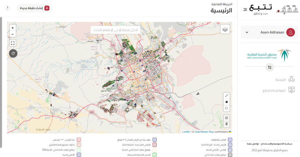
Section
Description
1
Owner
REDF
2
Project Objectives
To identify the quality of available Geospatial data, identify the gaps,
fill the gaps and answer critical business questions
3
Main Challenges
Different data sources leading to poor quality in terms of completeness, accuracy, and freshness
4
Spatial and Municipal
Sector Experts
Developing survey templates for locating and monitoring construction activities and their stages based on satellite imagery + processing templates using data from municipal plans and building permits.
5
Spatial Data
Scientists & Al
Developers
Building databases as a container for data generated from processing satellite images + geographically locating properties based on title deeds and municipal data + acquiring and processing satellite images to identify construction activities in the specified locations. SmartSAT had been intensively used here.
6
Field And Desk
Survey Teams
Conducting survey and evaluation work for 312 properties in Rania, Turabah, Dhalm, and Al-Muwayh within 3 hours and submitting the reports electronically.
7
Status of the Project
Successfully Delivered.
RESULT
Providing the Real Estate Development Fund with a detailed report on the construction status of all program beneficiaries within just 3 working days.
Updated databases for incomplete commercial licenses to guide customers to complete the necessary information.
Supporting decision making with data driven, satellite and field-based evidence, ensuring 100% accuracy in administrative choices.