GeoTech stands at the forefront of location intelligence, offering unparalleled expertise and innovative solutions. We excel in collecting and integrating diverse datasets, including geographic, demographic, and environmental data, ensuring a rich and comprehensive analysis. Our advanced analytics are second to none, utilizing cutting-edge Al and machine learning techniques to reveal deep insights and patterns.
We pride ourselves on our exceptional mapping and visualization capabilities, transforming complex data into clear, actionable insights through dynamic maps and interactive dashboards. Our real-time data processing abilities enable our clients to make swift, informed decisions, setting us apart in the industry.
GeoTech is renowned for delivering customized solutions tailored to meet the unique needs of each client, whether it’s for site selection, market analysis, or risk assessment. Our mobile and web applications are designed for maximum accessibility and ease of use, ensuring that clients can access vital information anytime, anywhere.
We hold data privacy and security in the highest regard, ensuring the utmost protection and confidentiality of sensitive location data. Additionally, our collaboration and sharing tools facilitate seamless communication and data exchange within client organizations.
GeoTech’s commitment to excellence in location intelligence is unwavering. We are not just a service provider; we are a partner in our clients’ success, driving innovation and delivering results that matter.
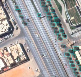
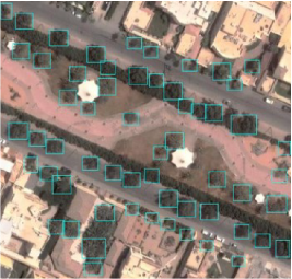
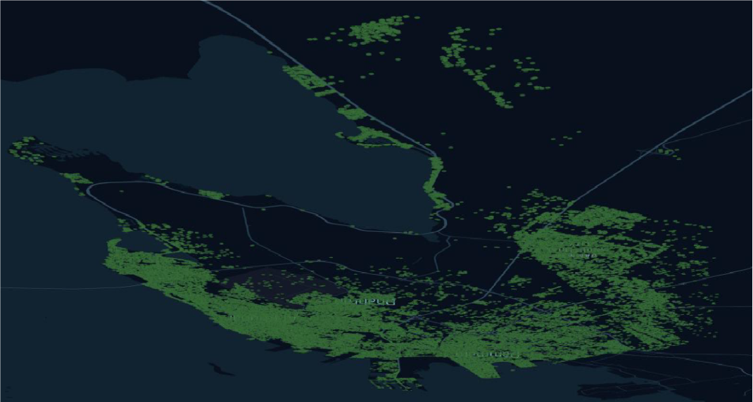
Trees Detection and Segmentation
Detection and segmentation tasks with our cutting-edge technology, delivering accurate and efficient identification of trees in satellite imagery for improved forestry management and environmental monitoring. The following information is determined for each tree using SmartSAT:
1. Location coordinates.
2. Tree diameter.
3. A unique identification number for each
tree.