Identifying Land Are/size Discrepancies
Between Moj Deeds And Momrah's Sdi
Section
Description
1
Owner
NRERSC
2
Project Objectives
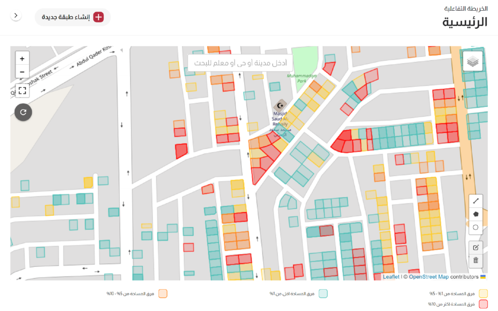
To determine the exact difference in land area/size between what is stated in the deed and what is calculated for each parcel.
3
Main Challenges
Several factors contribute to the difference in area/size in deeds and parcels.
4
Spatial and Municipal
Sector Experts
Identifying the main reasons related to discrepancies in the areas, boundaries, and lengths of land parcels and developing technical and artistic solutions for detecting such differences.
5
Spatial Data
Scientists & Al
Developers
Developing the necessary algorithms to harmonize between the spatial data in the Ministry of Justice and the spatial infrastructure for determining lands with varying degrees of discrepancy between the area specified in the deed and the areas determined according to the data of the Ministry of Municipalities, as well as the areas produced through the processing of satellite imagery and digital surveying. SmartSAT intensively used here.
6
Status of the Project
A sample consisting of 100,000 deeds has been delivered.
RESULT
Reducing the time and cost to determine discrepancies in land areas and adopting a proactive approach in identifying differences, rather than relying on deed holders or other parties.