Assessment Of The Sdi To Identify Gaps & To Automatically Generate Geodata To Fill The Gaps And Update Outdated Layers
Section
Description
1
Owner
MOMRAH
2
Project Objectives
To maintain an up-to-date SDI
3
Main Challenges
Cost of former methods of data generation and update.
4
Spatial and Municipal
Sector Experts
Developing the essential data templates, followed by constructing a data production matrix and a processing matrix to ensure and improve data quality.
5
Spatial Data
Scientists & Al
Developers
Producing the required data using artificial intelligence tools and satellite imagery, and then developing intelligent processing algorithms for matching and verification.
6
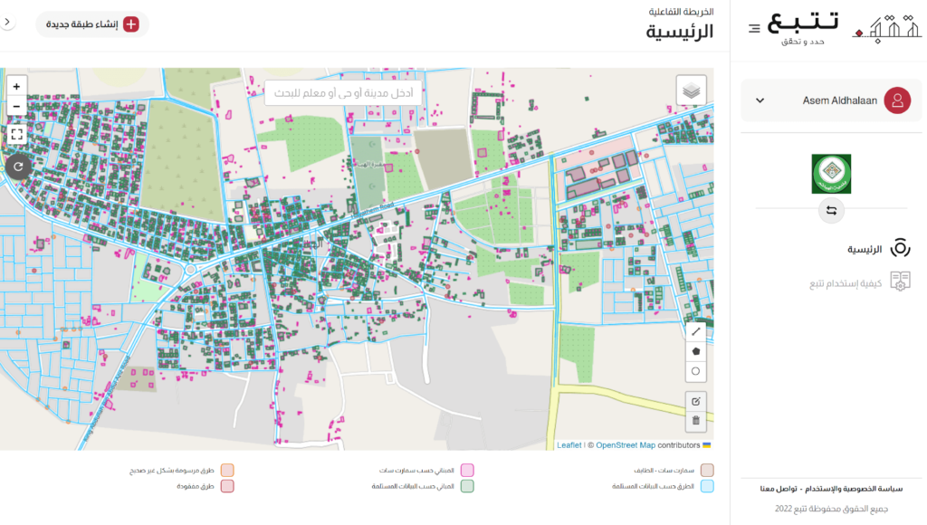
Status of the Project
The sample has been delivered in Al-Hayathem town + A technical and financial proposal has been submitted to generalize the experience across all regions of the kingdom, including 11 basic layers.
RESULT
Improving data quality and completeness from 61% to over 95%.
Discovering 49 missing streets out of a total of 600 streets.
Discovering 73 streets drawn with incorrect axis out of a total of 600 streets.
Producing a new building layer (using artificial intelligence) to address the severe shortage in the defined building blocks, which reaches over 50% in some areas.